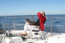


We spent 3 nights in Santa Barbara. It is a pretty large marina by our standards – “only” 100 guest slips are available and I think the dock from our finger was almost half a mile long. We had a nice slip, just one row back from the breakwater. It turned out there was a big three day concert on shore just off our berth. It would start at 4pm, and we were asleep before it ended. There were 14,000 spectators. We recovered from our trip from Morro Bay, did laundry, and enjoyed a visit from Earl’s aunt Donna. Every morning it was foggy, and every afternoon it cleared. In the evening we turned on the fancy underwater stern lights that Earl installed and watched the fish swim by. In addition to the usual herring, we saw larger fish that we finally determined were steel head. We think they are planted here.
As usual we met nice people around us. One was a family with three children on a sail boat going south for the Baja Haha. Another nice couple from Mammoth had spent some time in La Paz and the Sea of Cortez and had some tips for us. They had stayed at the Costa Baha Marina where we have reservations and liked it very much. However, they cautioned us that it was a ‘hot’ harbor and would eat our zincs.
On the 22nd, we left Santa Barbara and headed for one of the Channel Islands, Santa Cruz. We were concerned about choosing an anchorage after our last experience at Secate. The Santa Ana winds are blowing and, if they are strong, many anchorages are not suitable. We took a chance on an anchorage at the SE end of the island, called Smugglers. It was apparently well used by them in the past. A local sailor who was anchored there said that since we had an opposing wind off shore, he did not expect any strong Santa Ana to reach us. He was right, and we had a peaceful night for once.
Steve Elston had suggested more stats and maps, so I have included a couple of maps. As for stats: As of last night we had gone 1420 miles which is at least 30% more than the official mileage for the distance by the shortest route. We have added 183 hours to the engine and 130 to the generator. The biggest stat would be fuel usage. Unfortunately, I don’t have a clue what that has been, but past experience would suggest 2.5 per engine hour and 1 per generator hour for a total of 590 gallons. For the most part we have run at 1700 rpm. Because of the fog, we have used our flood light during the day which has required lots of hours on the generator.
We are currently running, once again in the fog, about 15 miles off shore on the way down to Long Beach which is just south of LA. We are bypassing Santa Monica where the Marina Del Rey has 6,000 slips, which seems overwhelming. The water is very clear and very blue and we have had multiple visits from porpoises which we have all enjoyed. With the very clear water, it was quite wonderful. If things go according to plan, we will be anchored at Long Beach by 5 pm, and then off to Dana Point tomorrow am.
Now that we are in the area of the LA harbor we are very glad for the AIS that Earl installed. I think the initials stand for automatic identification system, and large ships are required to broadcast their position on it. We have a receiver and can pick up the location and identification of the large ships on our plotter. Right now we can see 8 ships on the screen– oil tankers and cargo vessels. We can see their names, size, direction and speed. With the fog, it gives us a feeling of comfort over and above the radar.

No comments:
Post a Comment